by Ansgar Vollmer
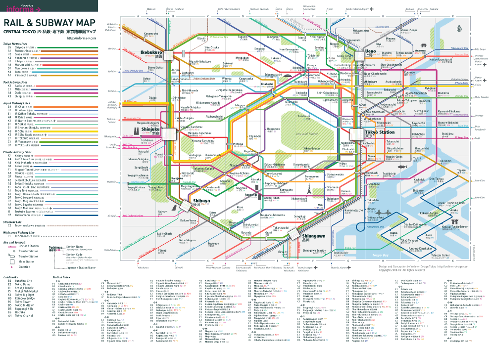
Possibly many first-time visitors to Tokyo feel like I did when I first arrived, read about › here. As fate would have it, I lived close to the Shinjuku Station in Tokyo and it took me awhile to understand how it all worked. The thought of my first arrival in Tokyo at this station motivated me to create clarity in the Tokyo’s rail network. A map that was independent of all railway companies and showed all the lines and routes.
Tokyo has been a place for travelers for centuries. It began during the time of the samurai and daimyo (feudal lords), and the city quickly developed after the introduction of newly-invented locomotive train in 1850’s and accelerated in the second half of the 20th century. This railway system continues to have a lasting impact on urban development to this day. What is known today as the center of Tokyo is determined by the Yamanote Line, a railway loop line connecting most of Tokyo’s major hubs.
In the past as department stores became bigger and richer, they built private rail services to bring more customers, but at the same time they were forbidden to build lines that crossed the Yamanote Line. These private trains would then be forced to terminate at the Yamanote Line tracks, and over time new suburban centers such as Shinjuku or Shibuya were created as a result.
Within this circle created by the Yamanote Line is the Imperial Palace, not far from Tokyo Station. Usually on maps it is simply called Tokyo, which is often understood by visitors as the city center but is actually merely one of the six major stations of this metropolis. Tokyo is the name of the prefecture.
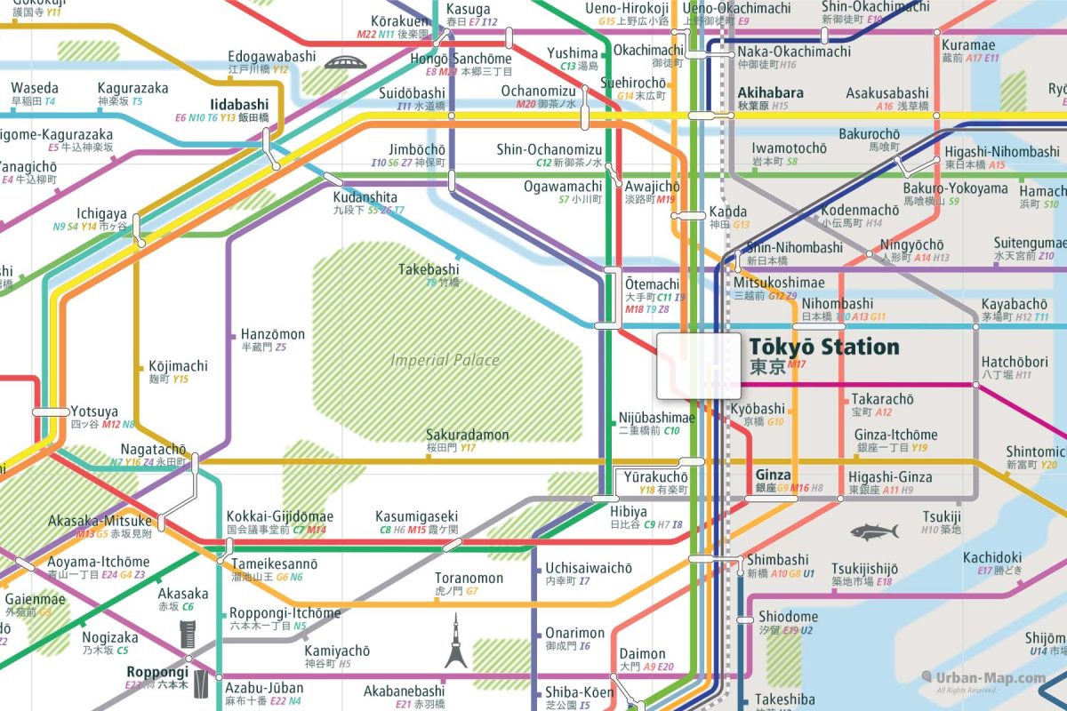
Transcribing the station names from Japanese into Roman script can be quite problematic. Once I met an American who was desperately lost and asked me for the station “Ibesu”. I couldn’t understand him and needed a moment before I realized that he meant the station Ebisu, which happened to be nearby. Minor changes to a Japanese word often change the meaning of the word completely. Therefore, our map also uses alternate spellings, e.g. Tōkyō to indicate that the pronunciation is to be observed. Showing both spellings has advantages because the Japanese spelling is compact, compared to the string of Roman alphabet letters that create some long and overflowing station names.
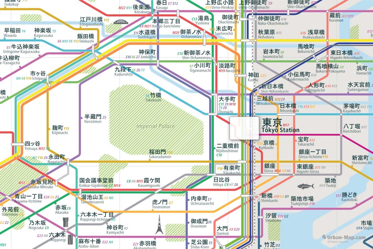
In cities like Tokyo, station names are often synonyms for places and addresses. Which line you live near or where you meet friends or work ultimately will determine the station which is the most suitable for you. These transport hubs are usually the centers of urban life.
In Tokyo, travel times of more than hour are not unusual. Finding the best connection to your destination becomes a challenge. If your starting station is a poor choice, e.g., because this station is the closest to you, your journey could become an Odyssey of transfers. It could be helpful to know that another station on the other side of the street might be the better choice because it is more direct or requires fewer transfers to your destination.
In modern cities like Tokyo, its stations and routes define its urban life. It may become even more important in future. That’s why City Rail Map has been designed as a cognitive map, an easy-to-understand model which offers essential functions such as your location via GPS, the ability to mark your favorite places, an search function and a list of all of the stations within the metropolitan area, all of which is available even if you’re offline.
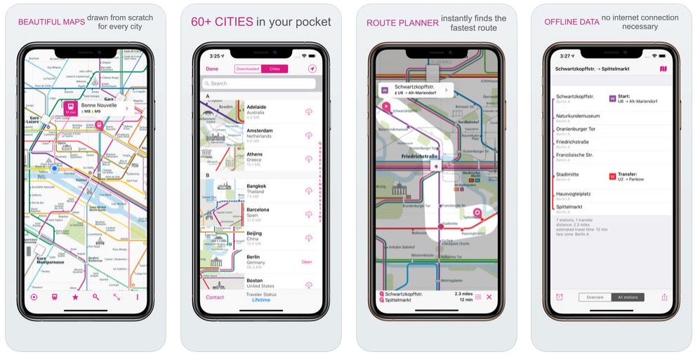
It is as important as a compass was to early explorers and our maps are clear and easy-to-use tools for urban life. If you are familiar with the style and graphical syntax, then all other City Rail Maps will be easily understandable.
A significant advantage of our maps is that it only contains relevant information about the city, and so you won’t find yourself travelling beyond what is considered “the city”, something that often happens with most mobile map apps. You will be where you want to be and with all the travel information you need, in a simple all-in-one modern and advanced city map.
It’s gratifying to read in the reviews that the design of City Rail Map is helpful to so many people. Thanks to all our millions of users. Become a sponsor and benefactor of a city of your choice, too. Read more › here.
Ansgar Vollmer
Designer & Creator of Urban-Map’s City Rail Map
Interesting Items
City Rail Map – Better Urban Life
› Read how design provides a better overview

Sponsor a Map of Your Choice
› Read how you can immortalize yourself