Download the full Paris Rail Map on App Store &
Google Play.
* Your first map is free!

Paris Rail Map - Available now as a poster!
- Paris Rail Map - Poster 40x60 cm
- Paris Rail Map - Poster 60x90 cm
The poster of the Paris Rail Map is available in the Urban-Map online print shop worldwide.
Printing, delivery and service by Spreadshirt. Production and sales are in Europe, America and Australia and available to ship worldwide.
Poster edition, get yours to day!
The City Rail Map app provides a map guide for the city of Paris
The Paris Rail Map includes the public transportation system, as well as many major landmarks and points of interest. In addition to the maps, the City Rail Map app for mobile devices provides a route planner, the ability to search for all transport lines and station locations and connections, GPS support and many more features for your city trip. The handy › City Rail Map is therefore the ideal companion for traveling and getting around the city.
Discover this app for your city trip.
The app includes Paris and even more 60+ cities.
See why travelers love the app:
- Offline maps and navigation!
- Distance, travel time and transfer information
- Favorite places
- Walking directions
- Address lookup
- Optimized for all your devices
Find out more about the City Rail Map › here.
Images of the Paris Rail Map
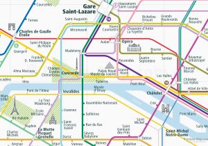
Below you can get a glimpse of the Paris Rail Map. The full version of the map, including all main transportation routes and lines on rail and partly also bus and ferry. Special clearly marked stations, transfer hubs and interchanges for line transfer, as well as station names and landmarks represented. The Paris Rail Map can be loaded in the › City Rail Map app.

