An app as handy as a Swiss Army knife
by Ansgar Vollmer

Major metropolitan cities like New York, London or Tokyo have been able to develop due to their use of the rail transport to shuttle millions of inhabitats around the city. › Read how a city’s character is designed.
All these world cities have expanded quickly in the last few centuries, as towns and villages grew and the population exploded.
It is difficult to appreciate as a fist-time visitor, but when you line up the stops in its railway network, understanding this development becomes possible. Station names often indicate its past importance and it’s where these rail lines intersect that you can find the true action of the city.
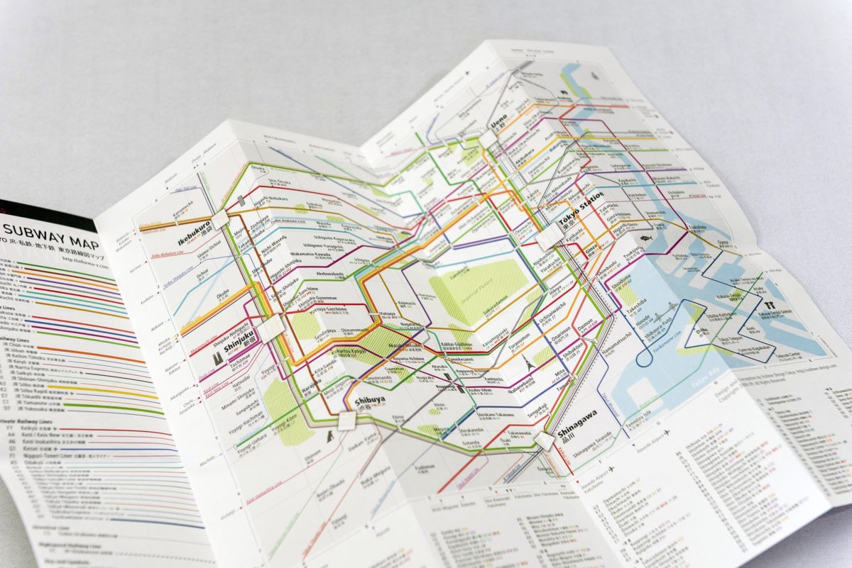
The “Rail & Subway Map Central Tokyo” in 2008 was the first map of the City Rail Map series. It was originally a printed pocket-size map. This map was specifically made for first and short-time visitors and mapped the area of most interest to visitors. But with the release of the iPhone it was suddenly possible to make an expanded digital map to show the entire urban region on your smart phone screen.
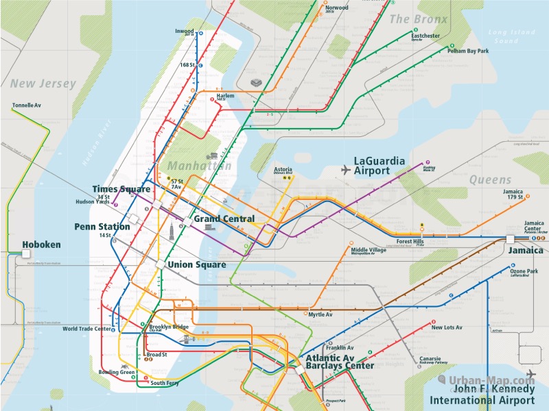
My first time in New York in 2001, I was surprised by this asymmetrical image of the city. The official New York subway map shows the center of New York, otherwise known as Manhattan island, on the far left side of the map, completely ignoring New Jersey and its important “Bridge and Tunnel” commuters, as the people of Manhattan often call them. That’s why our New York Rail Map also includes the eastern edge of New Jersey because today New York’s power extends to west of the Hudson river as well. Ideally, we plan to have a map that will encompass New York and Philadelphia along with all important stops in between. › Become a sponsor today and helps us make it happen.
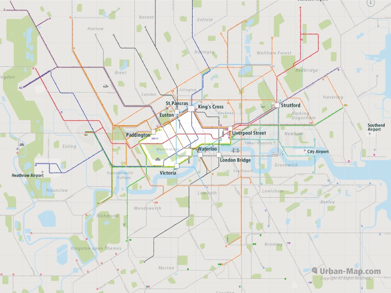
Bridges, tunnels and the famous Tube have had also a big influence on the development of London. The City of London was actually no bigger than a modern town, but through the rail network it has become gargantuan.
Today London also has 6 international airports surrounding the suburban area in all directions. That makes it necessary to have an overview where you arrive and where you will departure from. Don’t be like me, checking in at the wrong London airport 70 miles from where I needed to be. That chaotic taxi ride to the correct airport was stressful and expensive.

Because of this, our London Rail Map and all other maps of the City Rail Map have the most important access points for planes, intercity trains and buses as well as boat services. This way, you’ll never find yourself off the map.
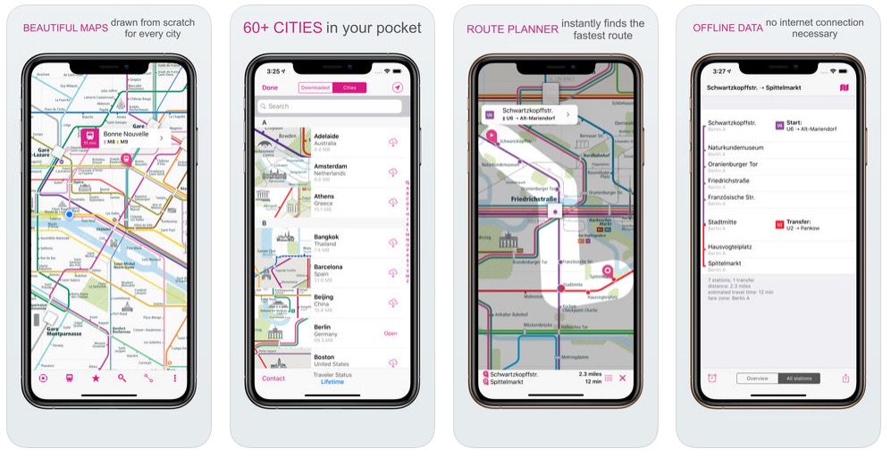
In any case, Urban-Map’s City Rail Map provides clear, all-important access points for the city, so that you are able to easily orientate yourself. Our maps include navigation, the ability to mark your favorite places to assist in planning, as well as travel times and a GPS location marker. Whenever you have a GPS signal, your position relative to the stations will be indicated. You will know where to go. You even have the option to set an alarm to notify you when you have to change trains at the next station.
In the future the City Rail Map app will also be available as an offline street map, which can show you the street you’re on and the way to your destination, even when you are on the move.
In addition, our future plans will be to create timetables for the exact schedule of your route including travel and departure time, managing the routing options and much more.
You will also have the possibility to make your own travel guide on the City Rail Map, with the option to share with friends and family. We are also working to provide selected partner services for tips, travel guides, hotel and restaurant recommendations, booking assistance and many more useful travel tools.

With Urban-Map, you are independent and free, even offline and you have the opportunity to create your own experience. If you’re on the move, the best way is to decide for yourself how and where you want to go. Find yourself, even offline!
Ansgar Vollmer
Designer & Creator of Urban-Map’s City Rail Map