Download the full Los Angeles Rail Map on ![]() App Store &
App Store & ![]() Google Play.
Google Play.
* Your first map is free!
The City Rail Map app provides a map guide for the city of Los Angeles
The Los Angeles Rail Map includes the public transportation system, as well as many major landmarks and points of interest. In addition to the maps, the City Rail Map app for mobile devices provides a route planner, the ability to search for all transport lines and station locations and connections, GPS support and many more features for your city trip. The handy › City Rail Map is therefore the ideal companion for traveling and getting around the city.
Discover this app for your city trip.
The app includes Los Angeles and even more 60+ cities.
See why travelers love the app:
- Offline maps and navigation!
- Distance, travel time and transfer information
- Favorite places
- Walking directions
- Address lookup
- Optimized for all your devices
Find out more about the City Rail Map › here.
Let the Los Angeles Rail Map show you the way where to go, where to stay and how to get there!
Los Angeles, a metropolis consisting of nearly 20 million people and a dozen cities, is located on the Pacific Ocean and is surrounded by high mountain ranges.
Sun Icon
Weather & Climate Los Angeles
The weather is mostly sunny and warm to hot with a dry climate.
Your clothes should be light and casual. A hat and sunglasses are recommended.
Airport Icon
Airports Los Angeles
The most common way to reach Los Angeles is by airplane. The Los Angeles International Airport is the biggest airport, but other airports also include theb Ontario International Airport to the east, Long Beach and John Wayne Airport to the south and in the north Hollywood Burbank Airport.
From LA Airport to Downtown by Metro and Bus the travel time is about 1 hour.
Los Angeles is well connected to › San Francisco, › New York, › Chicago, › Seattle and › Mexico City.
Marker Icon
Station & Hub Los Angeles
Union Station is located Downtown and is the terminal of the most commuter trains and the intercity and long distance trains from Las Vegas, Barstow, Palm Springs, San Diego and Santa Barbara. It is the main station and connected to metro and bus. A hub to Westside, Santa Monica, Long Beach and Orange to Oceanside or in the north to Hollywood, San Fernando and to Ventura. And finally from north to east direction towards Lancaster
Train Icon
Metro, Bus & Taxi Los Angeles
By Metro, Metro-Bus and train you easily reach most travel destinations within the city. Union Station is the hub where the trains, metro and bus connect. The Metro, a transportation system of subway, light rail and bus transit rapid system, provide a comfortable public transport system from early morning to midnight.
But in Los Angeles it is usual to hire a car or to use Taxi. You can find taxis next to the train station and to pay with credit-cards is normal. You should give 10% tip on top of the taxi fare.
Los Angeles Yellow Cab 424 222 2222
Home Icon
Accommodation Los Angeles
The best places to stay for business are Downtown and Westside. For vacation and family activities near the coast will be a better choice. For hiking and outdoor activities, you will find a good places near the mountains. In the southern neighborhoods are great to live and well to have a residence. You can also find many hostels in Santa Monica or Anaheim.
Eating Icon
Eat & Going Out Los Angeles
Nice coffee bars and small restaurants for eating you will find in Los Angeles in each neighborhood or city. A famous food of the city is the Pink’s Chili Dogs off Melrose and you will find many possibilities near the 3rd Street Promenade and Pedestrian Zone. For dancing and nightlife Santa Monica, Hollywood and the Westside are the places to go. For special features and popular places are Universal Studios, the Opera, Walk of Fame, Disneyland, …
Talking
Talking Los Angeles
English and Spanish are the common language. The people of the city, known as “Angelinos”, call their city “L.A., the City of Angels or La-La Land”.
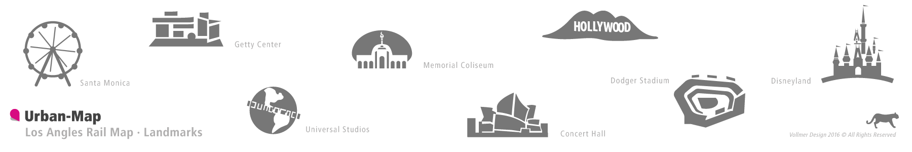
Images of the Los Angeles Rail Map
Below you can get a glimpse of the Los Angeles Rail Map. The full version of the map, including all main transportation routes and lines on rail and partly also bus and ferry. Special clearly marked stations, transfer hubs and interchanges for line transfer, as well as station names and landmarks represented. The Los Angeles Rail Map can be loaded in the › City Rail Map app.

